Widespread rain will spread over the state during the day on Saturday, ending in the southeastern sections by early Sunday morning. Total rainfall amounts will be 0.5-1.5 inches. A few snow showers may develop well north of I-20 Sunday morning, but no impacts are expected at this time.
The coldest air of the season will begin entering the state Sunday. For both next Monday and Tuesday (1/20-21), high temperatures will only reach the 20s north to 30s south. Low temperatures both next Tuesday and Wednesday (1/21-22) morning will likely range from the teens north to 20s south. Areas near and north of I-20 will not get above freezing from Monday through at least Wednesday morning.
Models greatly diverge on precipitation from next Tuesday through Thursday. Similar to the last event, an area of low pressure will develop in the western Gulf of Mexico on Tuesday and move eastward through the mid to latter part of next week.
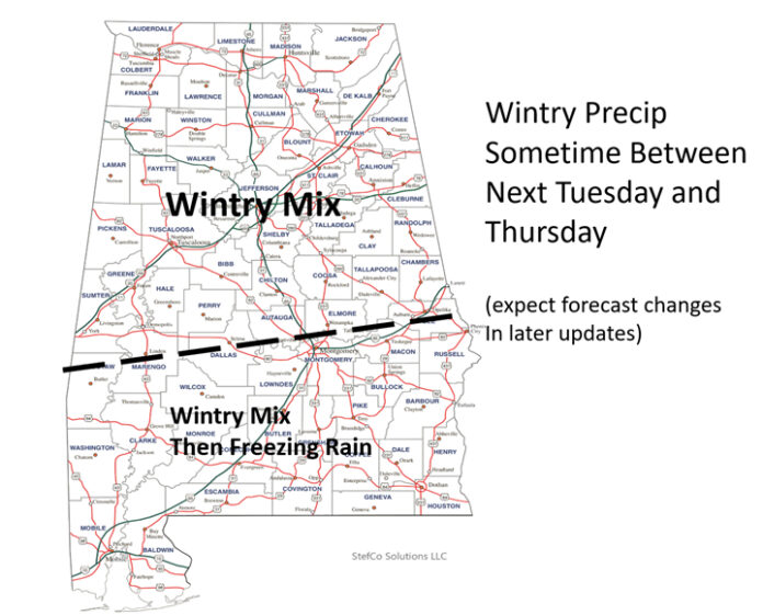
Although models are showing the precipitation anytime from Tuesday evening through Thursday, what they are indicating is some form of winter precipitation across Alabama, including snow, sleet and freezing rain. There have been some increases in the chances of freezing rain across the southern half of the state.
In addition, it is possible that temperatures remain below freezing near and north of I-20 next Monday through at least Thursday, but there is still much uncertainty beyond next Wednesday morning.
Due to continued uncertainty, do not believe any single model concerning precipitation type and locations right now. Stay up to date with the latest forecasts. More consistency is expected by this weekend.


