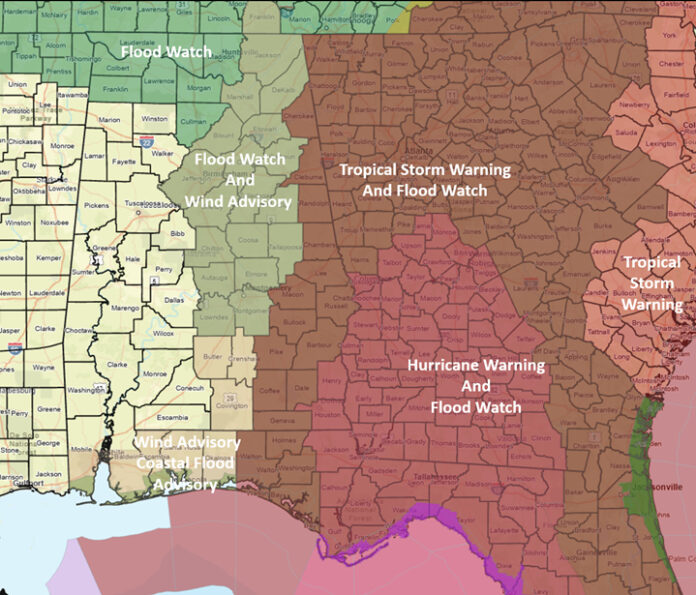
CLANTON, Ala. — Helene is forecast to make landfall in the Florida Big Bend area between 7-11 pm as a Category 3 hurricane with sustained winds of 115 mph. The center of Helene will move quickly through Georgia at 25-30 mph, being in the vicinity of Atlanta with 60 mph sustained winds at 7 am Friday and into northern Tennessee with sustained winds of 35 mph by 1 pm Friday.
The good news for Alabama is that the eastward shift in track and slightly lower wind speeds have somewhat lessened impacts to the eastern sections of the state. Still, winds will be on the increase with gusts from 25-35 mph this afternoon south of I-20 and near 40 mph at the coast. From this evening through early Friday, statewide gusts will be 25-35 mph and 35-40 mph in far eastern Alabama. From Friday morning through the afternoon, statewide gusts will be 25-35 mph. All gusts will drop below 30 mph after 7 pm Friday.
There could be down trees and some power outages with these gusts.
There is no tornado threat for Alabama.
Rain with a few thunderstorms will be spreading north and west today through tonight, with the bulk of the precipitation across the northern sections and eastern half of the state. From Friday morning through the afternoon, scattered to numerous showers will occur north of I-20. A few showers may linger into Saturday north of I-20, but nothing significant. By Friday evening, total rainfall amounts of 2-6 inches are forecast for the northern sections and eastern half of the state, with locally higher amounts. This could produce areas of flooding.


