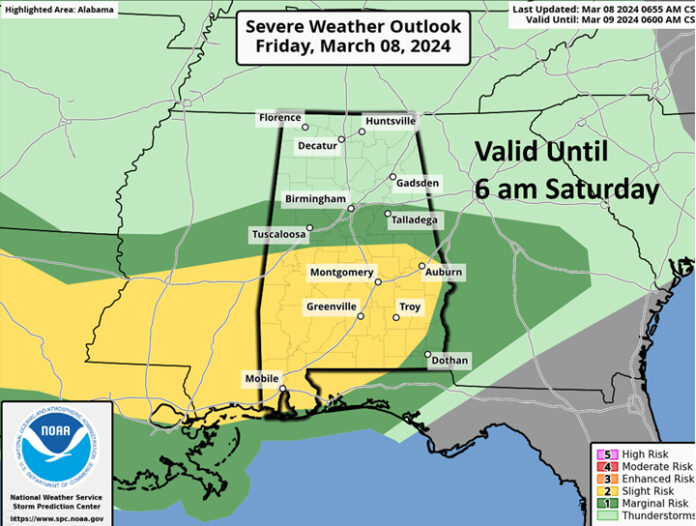
CLANTON, Ala. – Flood Watches will go into effect later today for much of state with a growing concern of significant flooding later this afternoon and Saturday morning.
Across the northern half of the state, a large area of rain and thunderstorms will move into the western sections after 7 am and spread eastward during the remainder of the morning. Although a damaging wind gust or two are possible, severe weather in unlikely this morning. However, heavy rainfall will occur.
Additional thunderstorms will develop across the western portions of the state and move eastward this afternoon into Saturday morning. The threat for damaging winds and tornadoes could begin between 12-3 pm in the southern sections of Alabama and likely not until 6 pm – 12 am elsewhere.


Somewhere near or south of I-20 an area of at least 4-6 inches of rain is forecast by tomorrow morning with some spots receiving 6+ inches. Flash flooding is likely in some areas. River and major creek flooding will occur into next week.
Since severe weather will be possible during the overnight hours, it’s critical you have at least two methods to receive warnings that can wake you up, one of which is NOT an outdoor warning siren. Also, remember that straight-line winds from Severe Thunderstorm Warnings can cause significant damage, but most of these will NOT come through the Emergency Alert System (EAS) or your phone. Tornado and Flood Warnings do get transmitted through EAS.


