A few thunderstorms may develop this afternoon north of I-20 and west of I-65. If so, a couple of storms could produce wind gusts of 40-60 mph and hail. In addition, non-thunderstorm wind gusts will be 20-30 mph and continue through Sunday morning.
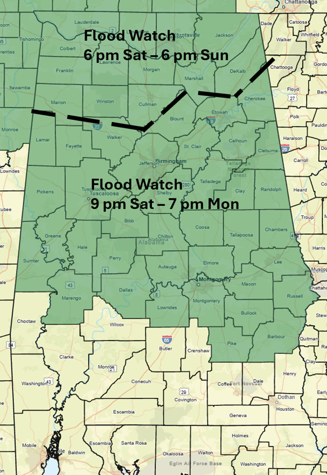
A Flood Watch has been issued for the northern 2/3 of Alabama beginning this evening. A line of strong to severe thunderstorms along a frontal boundary will enter northwest Alabama after 9 pm this evening and move southward overnight. Weather models are now indicating the frontal boundary will stall Sunday somewhere near or south of I-20. The leading edge of the storms along the frontal boundary, with the greatest severe weather potential, will continue to progress slowly southward Sunday into Monday. The storms will reach south Alabama Sunday evening into Monday morning. Numerous showers and non-severe thunderstorms are now forecast to develop behind the front and continue through Monday afternoon across the central and southern portions of the state.

Along the leading edge of storms, damaging wind gusts, hail and a couple of tornadoes are possible. Widespread 2-4 inches of total rainfall, with some spots receiving well over 4+ inches of rain are possible, which may result in flooding issues.


