Scattered to numerous showers and thunderstorms will move across the state from Saturday afternoon through early Sunday afternoon. A couple of storms on Sunday could have wind gusts from 40-60 mph and hail, but widespread severe weather will not occur. A break in precipitation from Sunday afternoon into the evening hours will allow the atmosphere to destabilize.
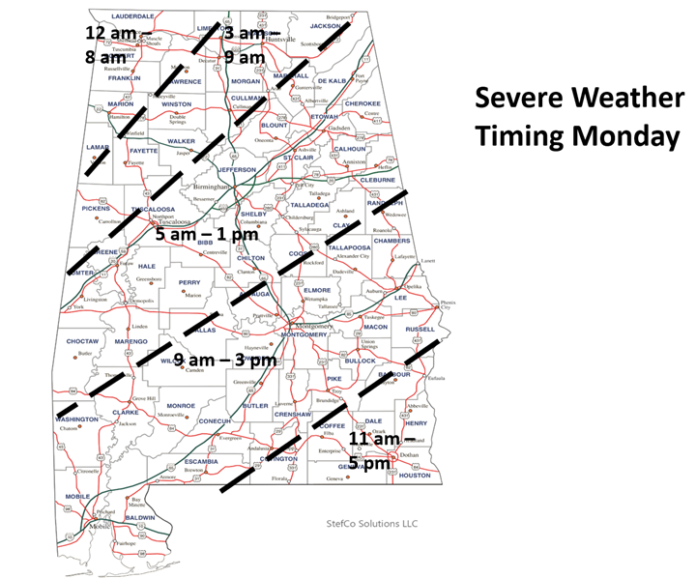
A line of thunderstorms will move into northwestern Alabama after 12 a.m. Monday and exit the southeastern portions by 5 p.m. A few severe storms could develop both close to and ahead of the line, but this development remains uncertain.
Damaging wind gusts up to 70 mph, large hail up to 2 inches, and a few tornadoes are all possible, especially across the Enhanced Risk area in northwest Alabama.
Total rainfall today through Monday will be 1-3 inches, with locally higher amounts in stronger storms. This could result in some flooding issues, especially in urban areas from Sunday into Monday.
Make sure you have at least two methods to receive severe weather warnings that can wake you up during the night, one of which is NOT an outdoor siren.


