CLANTON, Ala. — An upper-level disturbance will move across the southern US Thursday night into Friday. Scattered to numerous showers and a few thunderstorms will enter northwestern Alabama early Friday morning, moving eastward across much of the state through the evening hours. A couple of severe storms are possible Friday afternoon in the far western sections of the state where instability will be highest. Wind gusts from 40-60 mph, hail to quarter size and even a tornado are all possible.
This will be followed by another upper-level disturbance moving through the southern US Saturday into Sunday morning. Scattered to numerous showers and thunderstorms are forecast to develop during the late morning hours across much of the state followed by more organized convection Saturday afternoon through early Sunday morning.
As a result, a nearly statewide lower-end severe weather threat is forecast Saturday afternoon into the evening hours. Wind gusts from 40-60 mph, hail to quarter size and even a couple of tornadoes are all possible. At this time, the greatest instability is forecast to remain in Louisiana and Mississippi, but this could change in later forecasts.
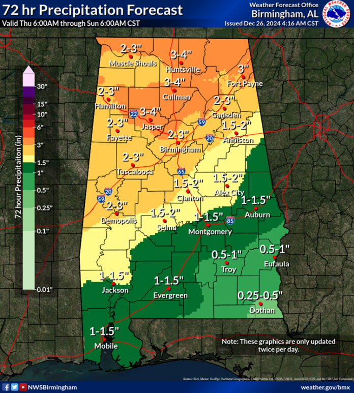
Rain and thunderstorms will exit eastern Alabama Sunday afternoon. Total rainfall amounts from Friday through Sunday will generally be 2-4 inches with potentially higher amounts across the northern half of the state and less than two inches across the southern half.


