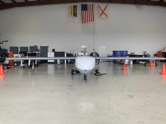
VINEMONT, Ala. – Cullman Regional Airport has been working in conjunction with the U.S. Department of Energy (DOE) Atmospheric Radiation Measurement (ARM) user facility and housed government-owned, contractor-operated uncrewed aerial systems (UAS) – or drones – to collect atmospheric data to assist the DOE with weather predictions and forecasts, storm patterns and air quality.
“It’s basically it’s a smaller version of the Predator, the one the military is using right now,” said Cullman Regional Airport Director Ben Harrison. “The cool thing for us is we are getting on the front end of this technology. The government chose to work with us.”
The flights took place from July 24-Aug. 7, 2024, while the user facility established an atmospheric observatory in the Bankhead National Forest. Over the two-week flight plan, ARM’s ArcticShark UAS collected meteorological measurements and recorded cloud, aerosol and atmospheric processes inside the observatory for atmospheric research while storing data about the humidity, temperature, cloud composition, trace gases, particles in the air such as dust and even the properties of the land surface.
Samples are collected through the ArcticShark’s nose, a fact that is an anomaly in the scientific and atmospheric communities, as most of the 21 atmospheric tools and instruments housed in the ArcticShark’s nose are usually as large as the ArcticShark itself in their normal forms.
Unmanned aircraft are used for these collection missions due to the precision in which they fly; precise and repetitive courses executed with the UAS autopilot system ensure that no data is skewed by user error. Pilots are on the ground, up to 100 nautical miles away from the aircraft, sending signals as the UAS completes the collection.
UAS Operations Lead Pete Carroll said, “We redundantly fly the same area over and over and over again at different times of the year, different times of the day to collect the different samples.”
The entire project is funded by the DOE, leaving the collection and data results free and open to the public, allowing students, scholars and home researchers to view the same data as the nation’s top scientists for research or academic purposes, free of charge.
“This is owned by the government and is called a government-owned, contractor-operated program. It’s free to everybody. So anyone that wants to use it to write a paper and use any of the past data from the last 30 years or so, it’s all there, all of it,” Carroll said.
Copyright 2024 Humble Roots, LLC. All Rights Reserved.


