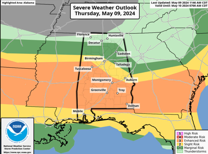
CLANTON, Ala. — Through 6 pm, the greatest threat of severe weather will be generally south of I-20 and east of I-65 where scattered to numerous thunderstorms will continue. Damaging wind gusts, hail, localized flash flooding and a tornado or two will be possible.

Additional thunderstorms are expected to develop after 6 pm somewhere between I-20 and Hwy 80/I-85 along the boundary left behind from this afternoon’s convection. Then an intense cluster or line of storms will enter western AL south of I-20 between 10 pm and 2 am and move from west to east, exiting the southeastern sections by 6 am.
Pockets of intense damaging wind gusts over 70 mph, hail, a few tornadoes and localized flash flooding will be possible. North of I-20, hail and possibly a damaging wind gust or two are the threats. In addition, a few storms may redevelop in far southeastern AL between 8 am and 11 am. All severe weather will end across the state by 12 pm Friday.
Most NWS Severe Thunderstorm Warnings WILL NOT trigger the Emergency Alert System (EAS) on your phone unless the NWS believes the winds will be at least 80 mph. Many people are surprised when they are not woken up by their phone even though considerable damage has occurred with winds below 80 mph.
This is why it’s critical you have at least two methods to receive all severe weather warnings like NOAA Weather radio (sold in many locations) or an app from a trusted source like the media. Never have an outdoor warning siren as a method as these can fail and are meant for people who are outdoors.


