CLANTON, Ala. – An upper-level system will produce rainfall mainly across the southern half of the state Monday evening into Tuesday. There could be some sleet mixed in with the rain at the onset Monday evening, but no accumulation nor impacts are expected.
Rain will move into the state late Thursday afternoon (22nd) and end Friday morning (23rd), with rain turning to snow Thursday night near and north of I-20, and potentially mixing with snow south of I-20 and north of Hwy 80 – I-85. An arctic airmass will invade the state Thursday night through early Friday morning.
Models are not consistent with total snowfall amounts, which is not unusual this far in advance with lower amounts expected. That said, the current forecast is for trace amounts near I-20, with 0.5 – 2 inches northward, especially north of the Tennessee River.
It should be noted that any snow on roadways combined with bitterly cold temperatures could lead to difficult and potentially significant road impacts.
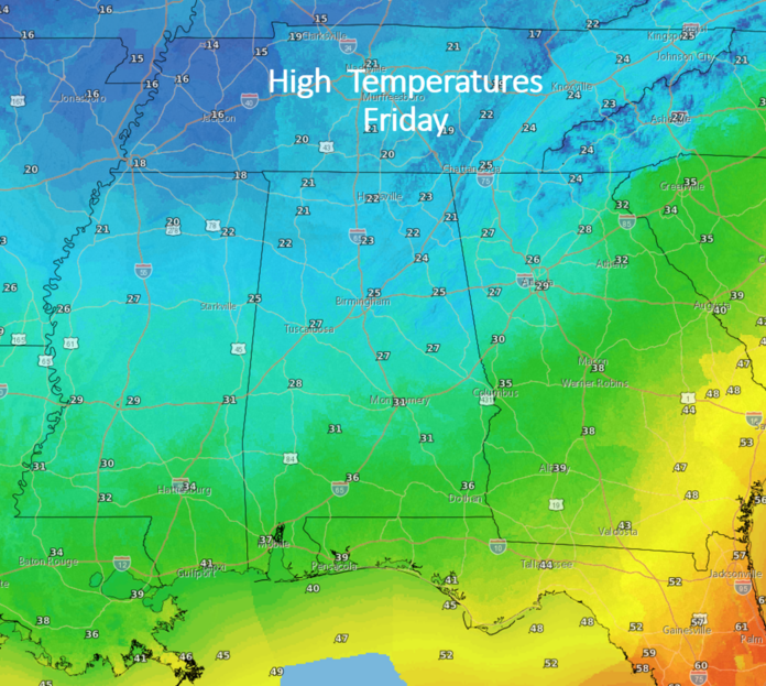
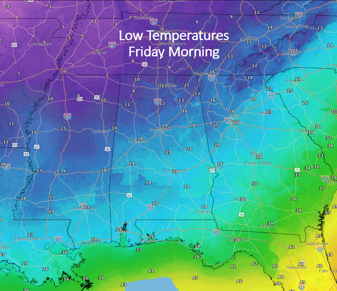
Temperatures by sunrise Friday are forecast to be in the single digits in far northern AL with mid to upper 20s along the coast. High temperatures on Friday will range from the lower 20s north to mid 30s south. Areas near and north of Hwy 80 – I-85 will not get above freezing.
Combined with sustained winds of 15-20 mph and gusts to 30 mph, wind chills will be -5 to 0 degrees in the north and lower teens south on Friday.
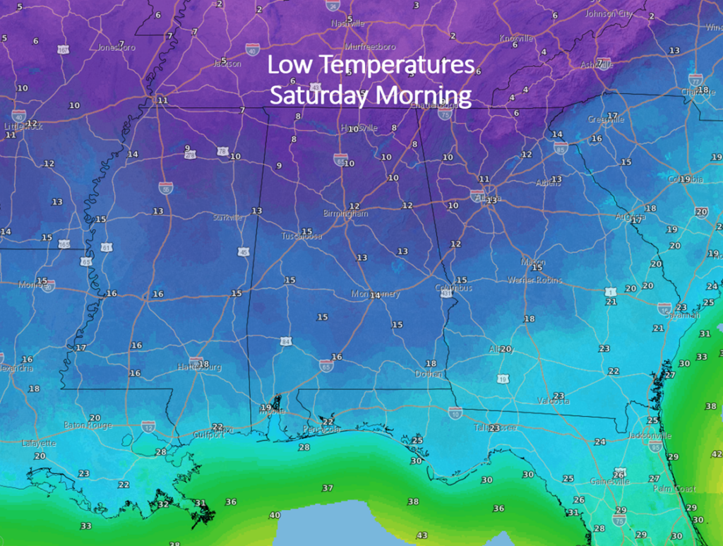
Unfortunately, it will be even colder Saturday morning with actual air temperatures in the single digits north to teens along the coast. Saturday afternoon will have high temperatures from the 20s north to around 40 at the coast. This will be the coldest temperatures in at least five years and possibly in the past two decades for portions of the state.
Temperatures will remain very cold Christmas Day and the 26th, and many areas of north AL will remain below freezing from early on the 23rd until the afternoon of the 26th or 27th.


